Business Details
Professional Aerial Photography Services for Real Estate & Commercial Clients
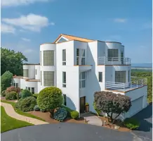
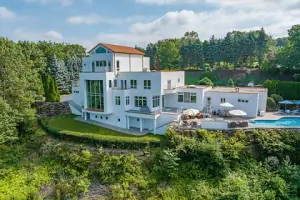
At AP3, we specialize in delivering high-quality aerial photography and video production services tailored to meet the dynamic needs of real estate and commercial clients. Our team of FAA-certified pilots and OSHA-trained professionals utilizes cutting-edge drone technology, including DJI Mavic 3 and Inspire 2 systems paired with Sony A7iii cameras, to capture stunning, high-resolution imagery. With a focus on the Hudson Valley, Northern New Jersey, and Pike County, Pennsylvania, we provide actionable media solutions such as orthomosaic mapping, 360 virtual tours, and virtual staging.Our commitment to safety, advanced equipment, and client-centric approach ensures reliable, precise results. We prioritize building trust through performance, offering single-property websites, floor plans, and weekly seller reports to enhance marketing strategies. Our services empower real estate agents, construction firms, and solar companies to gain a competitive edge through innovative visual storytelling.

Services
Aerial Photography
Real Estate Photography
Drone Videography
360 Virtual Tours
Floor Plan Design
Virtual Staging
Infrastructure Inspection
Orthomosaic Mapping
Single Property Websites
Construction Site Mapping
Highlights and features
- Our FAA-certified pilots ensure compliance and safety in all aerial operations.
- We utilize state-of-the-art Sony A7iii cameras and DJI drone technology.
- OSHA-certified team members guarantee site safety for construction and industrial projects.
- Specialized services include orthomosaic mapping and 360 virtual tours for diverse industries.
- We serve the Hudson Valley, Northern New Jersey, and Pike County with localized expertise.
Associations and certifications
- FAA Part 107
- OSHA Certified
Services
Aerial Photography
Our aerial photography services use advanced drones to capture high-resolution images of properties, providing unique perspectives for real estate marketing and commercial projects. We employ FAA-certified pilots and state-of-the-art equipment to ensure precision and safety. Clients benefit from enhanced visual storytelling that highlights property features and surroundings effectively.
Orthomosaic Mapping
Orthomosaic mapping creates detailed 2D maps of large sites using drone-captured images, ideal for construction, solar projects, and land development. Our Autel EVO and DJI Mavic 3 Enterprise systems ensure high accuracy and scalability. This service supports planning, progress tracking, and data-driven decision-making for commercial clients in the Hudson Valley and beyond.
Virtual Staging
Virtual staging enhances property listings by digitally furnishing empty spaces, helping buyers visualize potential. We use advanced software to apply customizable styles, improving appeal without physical setup. This cost-effective solution accelerates sales by attracting qualified buyers through immersive online experiences.
Infrastructure Inspection
Our infrastructure inspection services leverage drones to assess structures like water towers and construction sites safely and efficiently. High-zoom lenses and OSHA-certified teams ensure thorough evaluations without risking personnel. Clients receive detailed reports to maintain compliance and address maintenance needs proactively.
Single Property Websites
Single property websites offer branded, interactive platforms to showcase listings with unlimited images, 360 tours, and real-time updates. These sites include MLS integration, weather forecasts, and direct agent contact to streamline buyer engagement. Our clients gain a competitive edge with enhanced digital visibility and user-friendly tools.
People
Anthony Cioffi
CEO
Anthony Cioffi leads AP3 with expertise in aerial photography and FAA-certified drone operations. He ensures OSHA compliance and leverages advanced Sony and DJI equipment to deliver high-quality media solutions for real estate and commercial clients.
Questions
What areas does AP3 serve for aerial photography?
AP3 serves the Hudson Valley, Northern New Jersey, and Pike County, Pennsylvania, providing tailored aerial imaging solutions for real estate and commercial projects.
What types of commercial projects does AP3 handle?
AP3 supports construction firms, solar companies, and developers with orthomosaic mapping, infrastructure inspections, and progress tracking using advanced drone technology.
Can AP3 create virtual tours for real estate listings?
Yes, AP3 offers 360 virtual tours and Zillow 3D tours to enhance online property showcases, helping homes sell faster with immersive buyer experiences.
Is AP3 licensed and insured for drone operations?
AP3 complies with FAA Part 107 regulations and maintains insurance, ensuring safe, legal drone operations led by certified pilots for all client projects.
What equipment does AP3 use for aerial imaging?
AP3 uses DJI Mavic 3 and Inspire 2 drones paired with Sony A7iii cameras, guaranteeing high-resolution imagery and versatile capabilities for diverse client needs.