Business Details
9 Years
experience
Emergency
services
Professional Drone Photography Services
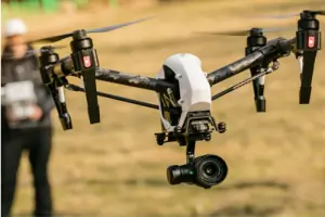
Aerial Site Works provides professional aerial drone photography, videography, and cinematography. Our team of licensed pilots and professional photographers combines technical expertise with creative vision to deliver high-quality visual content for real estate, construction, and insurance industries. With operations in Orlando, Columbus, and Dayton, we serve clients across residential, commercial, and industrial sectors. Our FAA-certified pilots utilize advanced drone technology to capture unique perspectives, including hard-to-reach areas without ladders or scaffolding.The team includes real estate professionals and film production experts with 15 years of experience in television production. We offer live streaming capabilities for construction site monitoring and maintain specialized insurance coverage ranging from $500,000 to $2,500,000. Our services extend to 7 countries, supporting diverse projects from property inspections to agricultural mapping. We prioritize client satisfaction through flexible scheduling, same-day service options, and comprehensive visual documentation tailored to specific project needs.

Services
Real Estate Photography
Aerial Inspections
Construction Photography
Appraisal Photography
Property Inspections
Agricultural Mapping
Commercial Photography
Industrial Photography
Roof Inspections
Utility Inspections
Details
- Year established: 2017
Highlights and features
- We are FAA licensed drone operators with 15+ years of film production experience
- Our team includes real estate professionals and certified photographers
- We maintain specialized insurance coverage up to $2,500,000
- We offer live streaming construction site monitoring capabilities
- Our pilots have flown in 7 countries across diverse industries
Associations and certifications
- FAA (Federal Aviation Administration)
Services
Real Estate Photography
We provide comprehensive real estate photography services capturing both interior and exterior views using professional ground and aerial equipment. Our FAA-certified pilots create visually compelling content for MLS listings, marketing presentations, and virtual tours. The service includes high-resolution images, video walkthroughs, and cinematic compositions that highlight property features while meeting industry standards for accurate representation.
Aerial Inspections
Our aerial inspection service utilizes high-resolution drone cameras to examine roofs, chimneys, gutters, and other hard-to-reach areas without ladders or scaffolding. This solution benefits homeowners, insurance companies, and utility providers through detailed visual documentation of property conditions. The service includes live video feeds, high-definition imagery, and comprehensive reporting for insurance claims, maintenance planning, or safety assessments.
Construction Photography
We offer construction site documentation through regular aerial and ground photography sessions that track project progress. Clients receive scheduled updates with high-resolution images and live streaming video options for remote monitoring. The service supports construction management by providing visual records of development phases, equipment placement, and project milestones while maintaining safety compliance on active job sites.
Appraisal Photography
This specialized service provides detailed photographic documentation for real estate appraisers and valuation professionals. Our FAA-certified pilots capture comprehensive property views that assist in accurate valuation assessments. The service addresses specific appraisal requirements through standardized image capture protocols, including roof condition analysis, site context documentation, and exterior feature evaluation to support valuation reports and lending decisions.
Agricultural Mapping
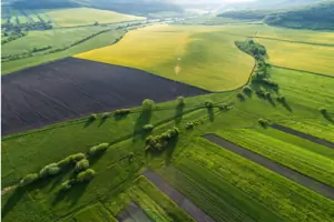
Our agricultural mapping service employs drone technology with specialized cameras to create detailed topographical maps and crop health analyses. The solution supports precision agriculture through data collection on soil conditions, elevation changes, and plant health indicators. Clients receive processed imagery and analytical reports that assist in land management decisions, irrigation planning, and crop yield optimization for commercial farming operations.
Questions
What services do you offer for real estate professionals?
We provide MLS listing photography, aerial imagery, and video marketing presentations for residential and commercial properties.
Do you have specialized insurance for drone operations?
Yes, we maintain specialized insurance coverage ranging from $500,000 to $2,500,000 tailored to specific job requirements.
Can you work at properties without the realtor's presence?
Yes, we can complete property visits independently while maintaining professional conduct and following client instructions.
How quickly can you schedule emergency inspections?
We offer same-day or next-day service for urgent inspection requests when weather conditions permit.
Do you provide live monitoring for construction projects?
Yes, we offer live video streaming from our drones to enable real-time construction site monitoring via secure online links.
What geographic areas do you serve?
We operate from offices in Orlando, Columbus, and Dayton with clients across the United States and international projects in 7 countries.